영국 남부와 유럽 대륙의 프랑스 사이의 해협(Strait of Dover)을 가로 지르는 최단 거리는 33.3km (20.7 마일, 18.0 해리)입니다.(from the South Foreland, northeast of Dover in the English county of Kent, to Cap Gris Nez, a cape near to Calais in the French département of Pas-de-Calais.)
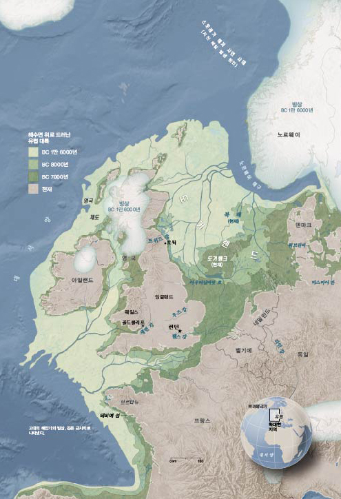
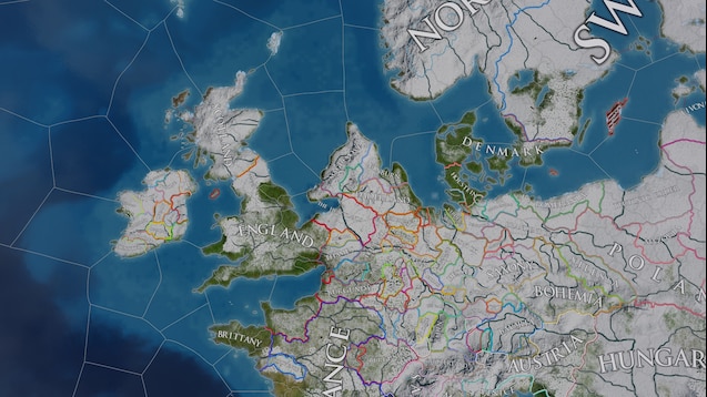
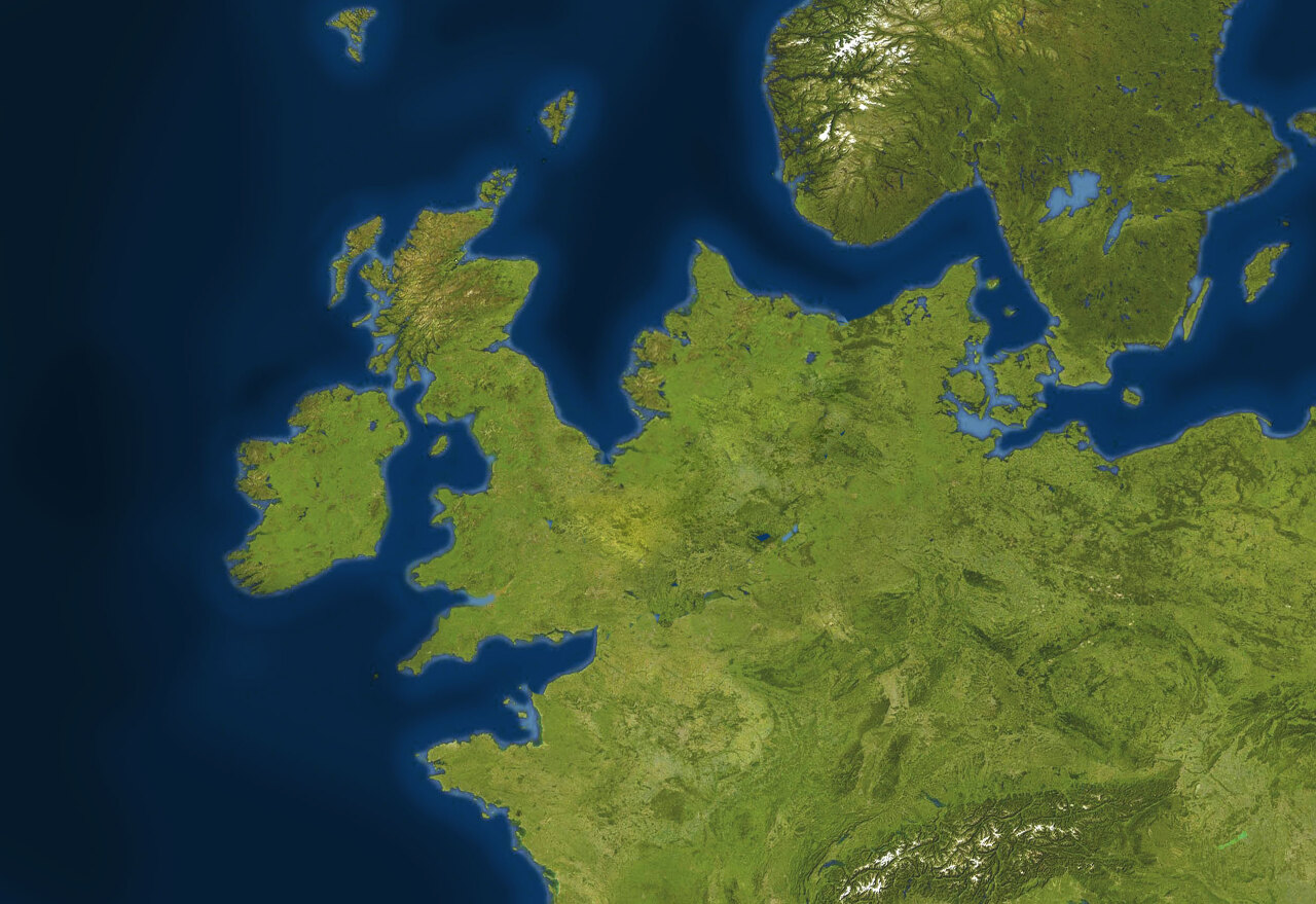
아래 책의 지도를 한참 들여다 보았습니다. 중국, 한반도와 일본이 육지로 연결되어 있었듯이, 유럽대륙과 영국이 도거랜드로 연결되어 있었다고 합니다.
도거랜드는 원시인류는 물론 영양이나 갈색 곰들이 오가는 육로였을 것이다. 기원전 6,500년-6,200년의 간빙기에 기후가 온화해지기 시작하자, 지금의 네덜란드와 인접한 도거랜드 Doggerland는 잦은 홍수와 쓰나미로 수몰되었고, 섬이나 습지로 남아 있다가 기원전 3,800년쯤에는 완전히 바다에 잠겼다.
아래
김언조, 영국사 다이제스트 100, 가람기획, 2021. 14-15쪽
en.wikipedia.org/wiki/Doggerland
www.nextnature.net/story/2009/mapping-a-lost-world
Doggerland - Wikipedia
From Wikipedia, the free encyclopedia Jump to navigation Jump to search Land mass now beneath the southern North Sea that connected Britain to mainland Europe Map showing hypothetical extent of Doggerland (c. 10,000 BCE), which connected Great Britain and
en.wikipedia.org


'환경' 카테고리의 다른 글
| 제초제 사망자의 절반, 그라목손은 어떤 제품보다 잡초 제거에 탁월 (0) | 2022.05.26 |
|---|---|
| 모래가 사라진다..시멘트·유리부터 실리콘까지 '빨간불' (0) | 2021.03.05 |
| 호주산불, 바닷물 온도 감지해 미리 알 수 있었다? (0) | 2020.02.04 |
| 모기 지옥 (0) | 2020.01.29 |
| 물에 잠겨 모기가 번식하고 말라리아가 확산되는 완벽한 환경 (0) | 2020.01.29 |